|
|
|
|
|

The Vigo Estuary, the southernmost of the Galician Rías Bajas, is a small paradise that contains many interesting corners.
The most famous islands in this estuary are the Cíes, which receive a multitude of tourists every year and which have beautiful beaches of very fine sand on their eastern side. Much less known are the Estelas islands, located in the southern part of the estuary, northwest of Bayona Bay and west of the Monteferro peninsula, in the municipality of Nigrán. These islands, by the way, have the same name as a group of islands located in the Berlengas archipelago, near Cape Carvoeiro, Portugal.

The best view of this small group of islands is from the Monteferro viewpoint, which is where I took this photo on December 15. In the image we see what the archipelago looks like: on the left, next to Monteferro, is the island of Estela de Dentro, the largest of the two main islands in this archipelago. Further west (on the right in the photo) we see the island of Estela de Fuera, which is somewhat smaller, and going a little further west there is a group of islets known as las Serralleiras. These islands are part of the Natura 2000 network and are classified as a Special Conservation Area (ZEC).

Here we see the island of Estela de Dentro. It has an area of 9.6 hectares and is about 500 metres from Monteferro. On this island is the only beach of the Estelas, a small strip of sand located in the southeast of the island. It is, surely, the only beach in the Ría de Vigo where you will never see tourists, since these islands are uninhabited, unless we count as inhabitants the birds of various species that are part of the fauna of the Estelas.

Above these lines, the island of Estela de Fuera. It has an area of 7 hectares. Between this island and Estela de Dentro there is a separation of about 400 meters. Both islands are shaped like plateaus, with vegetation on their upper part, and are surrounded by reefs.

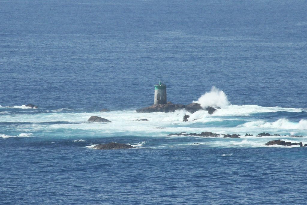
Finally, here we see the Serralleiras islets. They are a group of islets located about 500 meters west of Estela de Fuera. These islets have a total area of just over 2 hectares. On the main islet, called Serralleira, there is a lighthouse (or rather a beacon) that I showed you here in 2015:
Due to the reefs, navigation in this area is risky. In fact, these islands are linked to a sad event that occurred decades ago. On January 30, 1976, a Liberian-flagged bulk carrier, the "Ivy", sank between the Serralleiras and the Cíes, while sailing from Vitória (Brazil) to Rostock (Germany), transporting 30,000 tons of iron ore. A strong storm caused the ship to run aground and it ended up sinking northwest of the Serralleiras.
Unfortunately, the shipwreck claimed the lives of four Greek crew members, whose bodies were never found. All of the ship's cargo went to the bottom of the sea. Today, the wreck of the ship is a popular destination for scuba diving enthusiasts. You can watch a video posted by Javidele here showing a dive towards that wreck in August 2021:
|
Don't miss the news and content that interest you. Join Explorando for free on Telegram: Click here to join |


Opina sobre esta entrada: